On this page...
The Iowa Department of Education believes school districts must be adequately prepared for a variety of emergencies that threaten the young lives of Iowa students each day. Iowa Code 280.30 outlines the requirements for school districts and individual school buildings. In summary, it requires:
The development of a high-quality emergency operations plan (EOP), which shall include:
Response to active shooter and natural disasters
Alerting procedures for students, staff and to the employers of onsite non-school personnel
Development and publication of threat reporting procedures
Consultation with emergency management agencies and law enforcement for EOP development
Annual review of the EOP by the school board and authorities
Each school will conduct at least one exercise to validate the EOP
School Safety Newsletter

School Safety Newsletter
Receive timely information on legislation, resources, announcements and professional learning opportunities that support safe and supportive learning environments for all students and staff.
Prevention
Safe+Sound Iowa: School Safety Reporting System
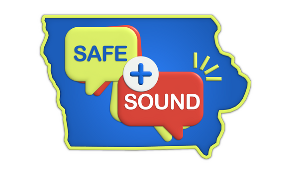
A free anonymous K-12 school safety reporting system is now available to help prevent violence, unlawful possession of weapons, self-harm and other forms of victimization and threatening behaviors in schools across the state.
Safe+Sound Iowa is available to students, school staff, parents and concerned community members to help identify and provide intervention for students in crisis before they hurt themselves or others.
For schools participating in the Safe+Sound Iowa program, a variety of resources are available to help train staff and encourage students and others to use the reporting tools available.
If your school has chosen not to participate, you will still want to be notified when a threat impacts one of your schools. For that reason, the Governor’s School Safety Bureau asks you to complete this School Safety Contact Form, if you have not done so already, so that you can be notified if a report impacts one of your district’s students or buildings. To learn more about providing contacts, see the Frequently Asked Questions.
Behavioral Threat Assessment Management
Iowa School Safety Assessment and Management (I-SSAM) Training Flyer (450.64 KB) .pdf
The State of Behavioral threat Assessment and Management in K-12 Public Schools (U.S. Secret Service)
Aligning Behavioral Threat Assessment and Management with a Multi-Tiered System of Approach (U.S. Secret Service)
Public Venue Bag Search Procedures Guide (Cybersecurity and Infrastructure Security Agency)
Back to topProtection
School Security Infrastructure Software & Technology Attestation Form
The Iowa Department of Homeland Security and Emergency Management (HSEM) is developing a list of organizations to provide school security infrastructure software or technology to Iowa schools. Visit the HSEM webpage for the attestation form, approved organization list, and security standards and policies. For additional questions, contact [email protected].
Back to topMitigation
Iowa School Self-Assessment Form - Request from Iowa Homeland Security and Emergency Management.
Back to topResponse
Planning
The links below are templates for developing school emergency operations plans.
Emergency Operations Planning
- Emergency Planning (SchoolSafety.gov)
- Iowa Sample School Emergency Operations Plan (755.25 KB).docx (755.25 KB) .docx
- Massachusetts School Emergency Operations Plan (2.32 MB).docx (2.32 MB) .docx
- Sample School Emergency Operations Plan (FEMA)
Reunification Planning
- Sample Reunification Plan (497.89 KB).docx (497.89 KB) .docx
- Reunification Method (“I Love U Guys” Foundation)
Forms
- Threat and Hazard Risk Assessment Tool (27.9 KB) .xlsx
- Injured and Missing Classroom Report Form (95.56 KB).docx (95.56 KB) .docx
- Iowa Threat Incident Report Form - Request from Iowa Homeland Security and Emergency Management.
- EOP Communications to Parents (21.78 KB).docx (21.78 KB) .docx
Recovery
School Safety and Crisis (National Association of School Psychologists)
Returning to School After a Crisis: A Guide to Addressing Traumatic Events at School (National Center for School Safety)
The NASSP Principal Recovery Network Guide to Recovery (National Association of Secondary School Principals)
Crisis Recovery (Center on Positive Behavioral Interventions and Supports)
Back to topTraining
Fire Drill Lesson Plans (19.58 KB).docx (19.58 KB) .docx
School Safety in Iowa—Prioritizing Mental Health as a Safety Strategy 1-27-26 episode of the BoardCast Podcast (Iowa Association of School Boards)
ICS For Schools/ Who Is In Charge? (International Association of Emergency Management) 2-4-26
National Disaster and Emergency Management University Training Curriculum and Programs(FEMA)
The following courses are recommended for those involved in school emergency response planning:
- IS-100.c: Introduction to the Incident Command System, ICS 100
- IS-360: Preparing for Mass Casualty Incidents: A Guide for Schools, Higher Education, and Houses of Worship
- IS-362.a: Multi-Hazard Emergency Planning for Schools
- IS-700.b: An Introduction to the National Incident Management System (NIMS)
Exercises
Cybersecurity and Infrastructure Security Agency (CISA) Tabletop Exercises
Homeland Security Exercise Evaluation Program Prep Toolkit
Back to topResources
- CISA Region 7
- SchoolSafety.gov - Emergency planning resources including webinars, tools, and sample plans for emergency planning.
- Iowa Homeland Security and Emergency Management
- Protecting America's Schools (U.S. Secret Service)
- School Safety and Crisis Planning Toolkit (AASA, The School Superintendents Association)