
During an emergency in a school building, minutes – seconds, really – make a difference. What’s the problem? Where’s the problem? Are students and faculty somehow involved?
Putting the right location data, on the right map, for the right people, at the right time can help answer those questions and enable emergency personnel to get to the scene as fast as possible.
Iowa’s Critical Incident Mapping program is offered to public and private schools in the state at no cost by the Iowa Department of Education through private contractor GeoComm, as part of Governor Reynold’s School Safety Initiative. The program will create and provide detailed indoor maps of schools and surrounding grounds, and key information needed by school safety authorities, public safety agencies, and first responders for streamlining and reducing response times to emergencies inside Iowa's schools.

The program creates detailed school maps including outlines of the rooms, offices, hallways, and other spaces and areas inside and outside of a school building. The program then provides secure apps for web browsers and mobile devices for viewing and interacting with the school maps during or when planning for emergencies.
The program also has the capability to show, in near real time, where emergency 9-1-1 calls are coming from, such as the specific room an individual is calling 9-1-1 on a cell phone. It also will provide advanced visual and tactical response tools that can be accessed by designated school personnel and other stakeholders as deemed appropriate by school administrators.
In addition to making these maps and apps available to authorized school personnel, schools will also have the option to share the maps with local public safety and emergency management agencies, such as 9-1-1 Public Safety Answering Points, fire departments, police departments and sheriff’s offices. The sharing of this crucial mapping data will aid in improving emergency response to every 9-1-1 call and emergency originating from school properties.
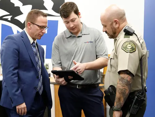
“The crux of critical incident mapping is that you can upload the school floor plan or blueprint and GeoComm will transform it into public safety grade actionable data on a map for use during school emergencies,” said Ethan Credle, the project manager of the Iowa Critical Incident Mapping service provider GeoComm. “When an emergency occurs, emergency personnel can pull up the maps. They can see where the 9-1-1 calls are coming from. They can see layouts of each floor. They can pinpoint each room, and visualize areas outside of the school.”

The first stage of the program will open a secure web portal where schools can upload any available floor plan documents. Next, GeoComm will be conducting site visits to all participating schools for data collection/verification and creation of the detailed school maps. Later stages will turn on the end user mapping apps, and configure data sharing with local public safety agencies.
The Iowa Department of Education and GeoComm are working with what they call a “lighthouse” school district – Dike-New Hartford Community School District – to fast track the contracted Critical Incident Mapping implementation, to provide an example and a pattern for other stakeholders and participants to see in action.
All participating schools are scheduled to have these maps, apps and tools available for use by February 2024.
“It’s incredible how much time can be saved with first responders being able to pull up a map of our schools,” said Dike-New Hartford Community School District Superintendent Justin Stockdale. All four of the district’s buildings, which house about 900 students, are now mapped.

“The active shooter is where our conversations tend to go in this context,” he said. “But any time you have an emergency, it increases response time and minimizes harm to the students and staff. This could work for fires or tornadoes, as well.”
Grundy County Sheriff Kirk Dolleslager, whose agency will be incorporating the school district’s program into their emergency preparedness, said he’s impressed.
“This is excellent for law enforcement,” he said. “It is trend-setting and something that all law enforcement across the state will want to have as part of their emergency response.”
Scott Dryer, a consultant for the Iowa Department of Education, said districts can sign up for the program by going to CASA and filling out a survey.

“We ask just a few questions so that GeoComm can be prepared for their visit to your buildings,” he said. “The collaboration between the Governor’s School Safety Program, GeoComm, Iowa schools and the Department has put Iowa in a position to quickly, efficiently and effectively put critical incident mapping software in the hands of school leadership and the emergency management officials that serve their area.”
Stockdale said he’s confident school districts will be jumping at the opportunity.
“It’s a no brainer,” he said. “The basic premise of what we do is to keep kids safe. If we can’t do that, why are we in this business?”